Sports
Orlando weather: Sunshine returns, river flood warnings continue
By Katherine Langford
Advertisement · Why this ad?
Marcus manages the day-to-day editorial workflow across all brands, coordinating coverage assignments and ensuring editorial standards are met. He previously served as city editor at the Pioneer Press and holds a degree in Political Science from Carleton College.
More from Marcus →
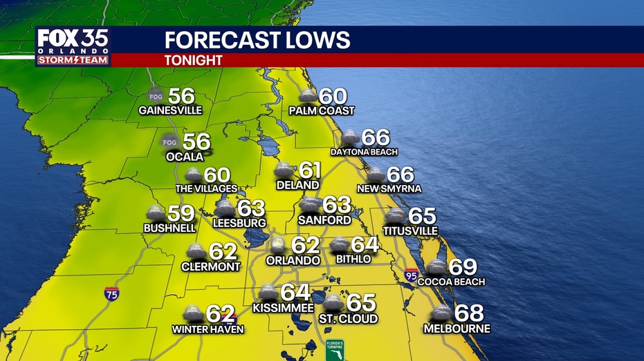
A nice start to the week will give way to scattered thunderstorms Wednesday, followed by a strong cold front Thursday night.Behind that front, Central Florida is on track for its COLDEST AIR OF THE FALL SEASON this weekend!Meanwhile, significant flooding continues along the St. Johns River, with additional rises expected.Weather changes this weekMonday & Tuesday: Patchy dense fog is possible early this morning, especially around the I-4 corridor. Otherwise, a mix of sunshine and clouds with comfortable humidity and highs in the lower 80s. Morning temperatures generally range from the upper 50s to upper 60s. Mostly dry conditions continue through Tuesday.Wednesday: Rain chances are increasing as an upper-level disturbance arrives earlier than previously anticipated. Expect scattered afternoon and evening showers and thunderstorms, with rain chances around 30-40%. Highs reach the lower 80s. While most storms should remain ordinary, a couple could become strong if sufficient instability d
By Katherine Langford

By Marcus Chen

By Katherine Langford

By Katherine Langford